The Rohtang Pass to Manali distance is 51 kilometres via NH-3 — but distance is the least useful number for planning this journey.
What matters is time: the descent takes anywhere from 2 hours on a clear September morning to 6 hours on a peak-season weekend afternoon, depending on traffic, road surface, and when you leave the summit.
Planning at a Glance
| Season | Road Surface | Typical Descent | Worst Case | Main Risk |
|---|---|---|---|---|
| May (opening) | Worst of year — broken tarmac, meltwater | 3.5–4 hrs | 5 hrs | Ice on shaded corners, surface debris |
| Jun–Jul | Patchy — repairs underway | 3–4 hrs weekday | 6 hrs weekend | Traffic volume, early monsoon landslides |
| August | Variable — active monsoon damage | 3–4 hrs when open | 6+ hrs | Road closures with no notice |
| Sep–Oct | Best of year — stable, repaired | 2.5–3 hrs | 3.5 hrs | Early snowfall from late October |
The single most controllable variable is departure time. Leave the summit before 10:30 AM in peak season.
The permit system concentrates vehicles in a morning window, and by noon the Marhi-to-Gulaba hairpins are a slow procession with no room to overtake.
If you’re catching a bus or a flight from Bhuntar, plan around the worst-case figure in the table above.
Core Route Facts
- Distance: 51 km via NH-3
- Elevation drop: 3,978 m (summit) → ~2,050 m (Manali town) — roughly 1,930 m over 51 km
- Daily permit ceiling: 1,200 vehicles (800 petrol/CNG, 400 diesel), per NGT Original Application No. 237/2013
- BRO road status helpline: 1800-180-3232 (toll-free, covers NH-3; more reliable than social media)
The Four Segments: What the Road Actually Looks Like
The route passes through four distinct stretches, each with a different character. Reading them in sequence gives you a clear picture of the descent as a whole.
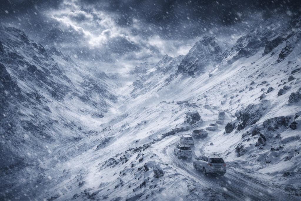
1. Summit → Marhi (51 km → 35 km | 3,978 m → 3,300 m)
Estimated time: 35–55 minutes
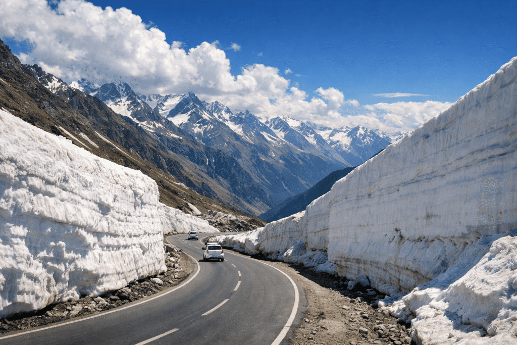
The most demanding 16 kilometres of the entire route. Freeze-thaw cycles through winter repeatedly crack and heave the tarmac; full repairs only happen after the pass opens each May.
From the summit, the road runs open and exposed across a high-altitude plateau before beginning a steep drop through a series of switchbacks toward the treeline.
In early season, shaded corners on these switchbacks hold ice well into mid-morning.
Specific hazards: broken tarmac and gravel patches in the first 5 km; sections narrowing to one vehicle’s width; runoff channels cutting across the road during rain; rockfall debris that road crews clear daily but which reappears overnight.
This is also where brake fade is a genuine risk. The gradient is steep enough that sustained braking generates heat leading to loss of stopping power.
Use low gear and engine braking throughout; the brake pedal is for corrections, not continuous load.
Source note: BRO’s own road-condition advisories for NH-3 (accessible via the Project Sampark helpline and posted at Marhi and Gulaba check posts each morning) consistently flag the summit-to-Marhi section as the primary surface-condition hazard. Himalayan road safety researchers at IIT Roorkee have documented brake fade as a leading cause of mountain road incidents on descents exceeding 1,000 m vertical drop — this segment descends 678 m.
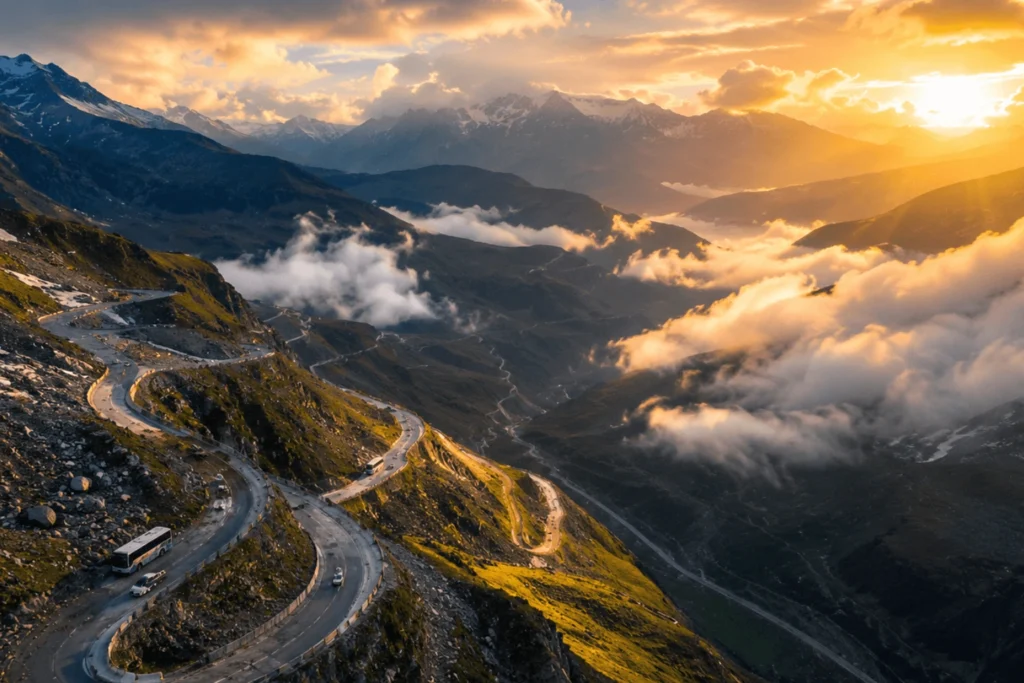
2. Marhi → Gulaba (35 km → 22 km | 3,300 m → 3,050 m)
Estimated time: 40–70 minutes
Marhi is where the road flattens briefly and the stall cluster — tea, snacks, toilets — makes it a natural stop for nearly every vehicle. Below it, the gradient eases slightly, but this is where traffic density peaks on the descent.
The hairpin sequence to Gulaba is the biggest time variable of the entire journey. A single breakdown or stalled vehicle in the hairpins can turn a 50-minute segment into a two-hour one.
At this point on the descent, the Kullu Valley has opened fully below — the Beas River is visible on the valley floor, and the pine slopes opposite are a clear landmark that you’re below 3,100 m and making genuine progress.
If you want photographs, find a pull-out on the straights; stopping mid-hairpin is both dangerous and blocks traffic.
3. Gulaba → Kothi (22 km → 15 km | 3,050 m → 2,530 m)
Estimated time: 20–30 minutes
Below the Gulaba check post, the character of the road changes. It widens in places, surface quality improves, and overtaking becomes possible.
Silver birch gives way to increasingly dense deodar cedar, and the road begins to feel like a proper mountain highway rather than a high-altitude track.
Loose gravel washed from slopes above remains a hazard after rain, but the acute technical demands of the upper section are behind you.
4. Kothi → Manali (15 km → 0 km | 2,530 m → 2,050 m)
Estimated time: 25–40 minutes
The Beas now runs alongside the road for much of this final stretch, and the tarmac improves markedly approaching Manali’s outskirts.
The valley floor is cultivated and the driving is relaxed. One caveat: arriving between 4:00 PM and 6:30 PM puts you into evening market traffic.
Mall Road and its approach lanes congest heavily as day-trippers return. Budget 20–30 minutes extra if heading to central Manali or Old Manali.
What Slows You Down Beyond Surface Conditions
Military convoys. The Manali–Leh Highway is a critical supply route for the Indian Army’s Ladakh operations. Convoys of 30 to 60 vehicles move regularly and take absolute road priority.
When one is ahead of you on the descent, your timeline adjusts accordingly — there is no way around it.
Road surface deteriorates through the day. Morning sun melts the top layer of compacted snow and frost on the upper section.
Vehicles descending in the afternoon encounter a looser, wetter surface than those who left at 7 AM.
Driver experience. A driver who knows the road anticipates the problem corners and doesn’t panic in the hairpin queues.
When booking in Manali, ask how many times the driver has done the Rohtang route this season — not just ever. Route knowledge goes stale.
BRO maintenance. Road work restricts traffic to single-lane alternating flow, adding 30–60 minutes. Restrictions are posted at check posts on the day but are not announced in advance.
Descent-Specific Driving Advice
These are the points specific to the downward direction that go beyond standard mountain driving caution.
Engine braking on the upper section. On the summit-to-Marhi drop, engage a low gear and use the engine to control speed — not the brake pedal continuously.
This isn’t optional advice; sustained braking on a steep descent generates heat that can cause brake fade, especially on vehicles that have just completed the climb up.
Right-of-way at single-lane hairpins. Ascending traffic has priority at pinch points — they lose momentum if they stop, you don’t.
Descending vehicles yield, pull to the outside edge, and wait. This unwritten rule is observed consistently on this road and keeps the hairpins moving.
Book drivers on recent route experience. A driver who last did Rohtang in a different season, or two years ago, may not know which corners are currently the problem ones.
Ask specifically: “How many times have you done this route since the pass opened this year?”
Checking Road Status
Before leaving Manali: Your hotel or driver will have checked road status through local networks. Ask the previous evening and again on the morning of travel.
At the summit: Ask drivers who have just come up from Manali — they have the most current picture of conditions on the lower stretches.
At Marhi: Stall owners receive a constant stream of vehicles in both directions and typically know about any landslides or blocks below. Stop and ask before continuing if conditions look uncertain.
BRO Project Sampark helpline: 1800-180-3232 (toll-free). Covers NH-3 including the Rohtang section. Call the evening before and again on the morning of travel.
The Atal Tunnel: If You Don’t Need the Pass Itself
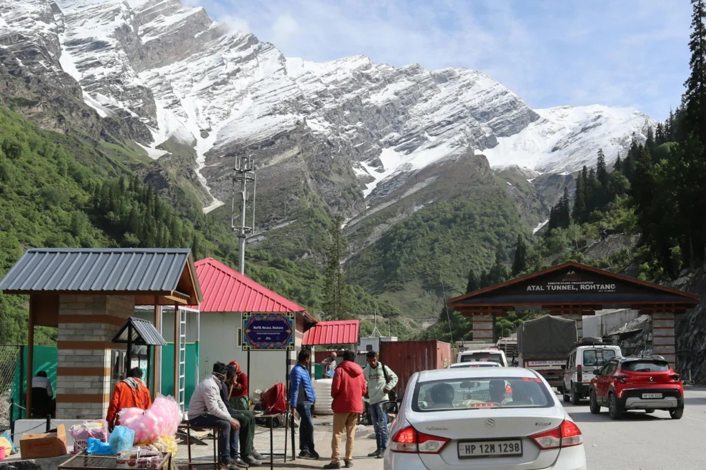
Opened in October 2020, the Atal Tunnel is an 8.8-kilometre all-weather tunnel through the Pir Panjal range at 3,060 m, connecting Dhundhi (near Solang Valley, ~25 km from Manali) to Sissu in Lahaul.
It completely bypasses the pass road above Gulaba.
If your destination is Lahaul, Keylong, Jispa, or the Manali–Leh Highway, you don’t need to drive to the summit at all. The tunnel saves 46 kilometres, requires no NGT tourist permit, and is open year-round.
Toll is ₹75 for cars (subject to revision); speed limit inside is 80 km/h, enforced.
If you’re going to Rohtang specifically for the snow and views, the tunnel is irrelevant — the pass road is the point.
Note that the tunnel’s south portal is at Dhundhi, not Manali centre, and the approach runs through Solang Valley on a different road from NH-3.
FAQ
Rohtang Pass is famous for its dramatic Himalayan scenery, snow-covered landscapes, and thrilling mountain roads. It also serves as the gateway between the Kullu Valley and Lahaul-Spiti region. Many travellers visit for snow activities, photography, and panoramic views of glaciers, peaks, and valleys.
The best time to visit Rohtang Pass is from May to October. June and September are especially popular because the roads are usually open and the weather is more stable. During winter, heavy snowfall closes the pass for several months.
You can reach Rohtang Pass from Manali by taxi, bike, private car, or local tourism vehicles. The distance is about 51 km via NH-3, and the drive usually takes 2–4 hours depending on traffic and road conditions. Visitors also need a permit during peak tourist season.
Manali is popular for shopping, cafés, scenic photography spots, spa retreats, and snow experiences. Many visitors enjoy buying woollen clothes, handmade jewellery, Himalayan skincare products, and Tibetan handicrafts from local markets like Mall Road and Old Manali.
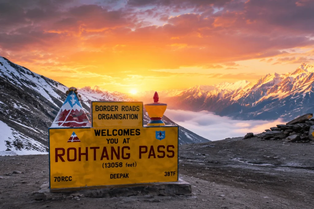
Yes, oxygen levels are lower at Rohtang Pass because it sits at an altitude of around 3,978 metres (13,050 feet). Some travellers may experience mild breathlessness, headaches, or dizziness, especially if they are not used to high altitudes. It’s best to stay hydrated, avoid overexertion, and descend if symptoms become severe.
Conclusion
The journey from Rohtang Pass to Manali may only cover 51 kilometres, but travel time depends far more on road conditions, weather, traffic, and departure timing than on distance itself.
In good conditions, the descent can take under three hours, while peak-season congestion or monsoon damage can easily double that estimate.
For most travellers, the key to a smooth trip is leaving early, checking current road updates, and using an experienced local driver familiar with the season’s conditions.
The upper summit section remains the most challenging part of the route, especially during the opening weeks after winter or during heavy rains.
If your goal is simply to reach Lahaul or continue toward Leh, the Atal Tunnel is now the faster and safer alternative.
But if you want the classic Himalayan experience — snow walls, dramatic hairpins, and panoramic mountain views — the old Rohtang road still delivers one of the most memorable drives in northern India.
Road conditions on NH-3 change rapidly with weather. Always verify current status with BRO (1800-180-3232) or local sources on the morning of travel. Rohtang Pass is open approximately May to November each year, subject to snowfall.